
Pagosa Springs ordered to evacuate as San Juan River set to break 1911 record
Archuleta County officials expect the river to crest at 21.87 feet Sunday night, surpassing the last flood by more than six feet and the previous record by four feet.
By Lucas Navarro ·
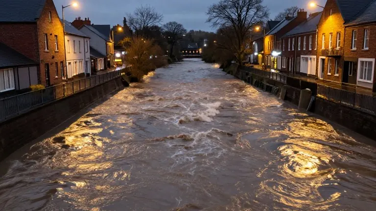
Archuleta County officials ordered mandatory evacuations on Sunday for residents in low-lying areas along the Rio Blanco, Navajo, Piedra, and San Juan rivers. The order includes downtown Pagosa Springs and areas near Stollsteimer Creek. This directive comes less than two weeks after a previous storm damaged over 500 homes and 150 miles of road in the same county.
The National Oceanic and Atmospheric Administration projects the San Juan River will crest at 21.87 feet by 11 p.m. Sunday. This level is 6.07 feet higher than the peak reached during the flood 10 days earlier. It also exceeds the historical record of 17.8 feet set in October 1911 by nearly four feet. The 1911 event destroyed much of the original town of Pagosa, according to the Archuleta County Sheriff’s Office.
Sheriff’s officials urged residents to leave immediately rather than waiting for water levels to rise or for further warnings. They stated that their ability to respond during the peak of the storm would be limited. Helicopters would be grounded, and first responders might not be able to reach people in danger until the storm subsides. The office described the event as potentially catastrophic and expected extensive damage.
Evacuation orders also took effect in Rio Grande and Mineral counties for residents along the South Fork of the Rio Grande River. The areas covered include the towns of Del Norte and South Fork. Monte Vista remained under a pre-evacuation notice as of Sunday. The Rio Grande is forecast to reach 9.5 feet near South Fork by 11 p.m. Sunday. This is higher than the previous crest of 9.03 feet.
Forecasters expect the river to rise to 10.5 feet near Monte Vista by 5 a.m. Monday. That level is higher than the previous crest of 9.37 feet. The Conejos River near Mogote is expected to reach 8.2 feet by 5 a.m. Monday, up from 7.88 feet during the last storm. The National Oceanic and Atmospheric Administration classified all these levels as major flooding.
Conejos County ordered mandatory evacuations from Platoro to Mogote in the Conejos River Canyon on Sunday morning. The remainder of the county remained on pre-evacuation notice. The Conejos County Sheriff’s Office advised residents to leave immediately and be prepared to stay away from their homes for multiple days.
The National Weather Service issued a flood watch for the San Juan Mountains and several southern Colorado river basins on Sunday. The watch covers Alamosa, Creede, Del Norte, Durango, Mancos, Monte Vista, Pagosa Springs, and South Fork. These watches will remain in effect through Tuesday. A separate flood warning was issued for the San Juan River in Pagosa Springs until Monday evening. Forecasters labeled the situation particularly dangerous.
Weather conditions will shift from heavy rain to snow at higher elevations in the San Juan Mountains. Snowfall is expected above 10,000 feet, with more than one foot of accumulation possible. The National Weather Service issued a winter storm warning, noting that such amounts could make travel very difficult or impossible.